Home › Travel & Vacation › Rio Claro-Mayaro › Fishing Spots › Nariva River Mouth, Mayaro, Trinidad and Tobago

Fishing Spots

Nariva River Mouth, Mayaro, Trinidad and Tobago

Manzanilla Mayaro Road, Mayaro, Trinidad

Island

Trinidad

Area

Mayaro, Rio Claro-Mayaro

Entry

Free Entry

Parking

On Street

Family friendly

Yes

About Nariva River Mouth, Mayaro, Trinidad and Tobago

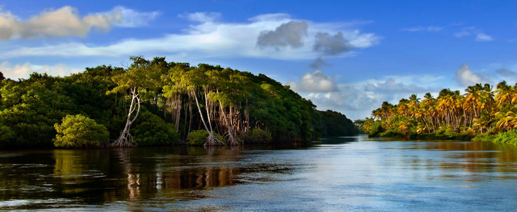
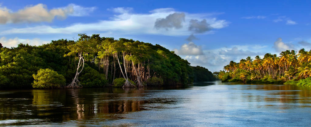
This is the largest river in Trinidad and Tobago, which is dark cream in colour. The bridge has been raised and replaced with concrete to prevent flooding. It is also a great place for fishing and kayaking. Category: Historical Sites, Trini Attractions, Beaches and River Spots, and Fishing Spots

Photos

Been here? Add your photos with a review and help the next visitor.

Getting there

Manzanilla Mayaro Road, Mayaro, Rio Claro-Mayaro, Trinidad and Tobago

Loading...

Map pin accuracy: Within Community. Some places are mapped to the nearest community rather than the exact spot, so check locally before you set out, and allow for road and weather conditions.

Reviews and tips

Been here? Share what it was like: when you went, what to bring, and any tips for the next visitor. Members earn rewards points for every review and photo.

Write the first review

1 Review on “Nariva River Mouth, Mayaro, Trinidad and Tobago”

Excellent
5
1 review
  • Muhammad L. Avatar Muhammad L.

    Surreal pretty and amazing to see. The Narvia river enters the sea in a huge mouth where you can get by boat or you can see from the Manzanilla Mayaro Road.

Leave a Review

Select a rating
Overall
Drop files here

OR

Allowed file types: .jpg, .jpe, .jpeg, .gif, .png, .bmp, .ico
(You can upload 10 files)
Please drag & drop the files to rearrange the order

Make a day of it

Places to stay, eat and visit near here, so you can plan the whole trip in one go.

Places to stay nearby

Staying over? Compare places to stay nearby on Expedia.

Compare hotels

TriniGo may earn a commission if you book through these links, at no extra cost to you.

Places to eat nearby

The Ranch of Mayaro

More places to visit nearby

Nariva Swamp

Cascadoux Trace Mud Volcano, Mayaro

St Joseph Statue

Former Mayaro Post Office

Mayaro Bay – Spot 1

Mayaro Bay – Spot 3

Been somewhere good? Tell Trinidad and Tobago about it

Join free to save your favourite places, share reviews that help the next visitor, and earn rewards points.

Two smiling friends looking at a tablet together

About the area

Things to know about Rio Claro-Mayaro

The Rio Claro-Mayaro region encompasses southeast Trinidad from the market town of Rio Claro to the extensive Caribbean coastline at Mayaro, representing one of Trinidad's most distinct regional identities. The region combines Rio Claro's commercial and service functions with Mayaro's beach tourism economy and surrounding agricultural communities. The area serves as Trinidad's primary east coast destination, offering beach experiences distinct from the north coast while maintaining strong agricultural connections. Communities throughout the region provide essential services, local businesses, and cultural amenities supporting both permanent populations and seasonal tourism. The region benefits from the Mayaro Road connection while preserving coastal character and agricultural heritage. Rio Claro-Mayaro continues to balance beach tourism development with community needs and agricultural activities, maintaining authentic character while improving infrastructure and service offerings.